
Mt Adams (5,799 feet) Randolph, NH. 2022-11-29 (Tuesday.)
Via Air Line Trail, Gulfside Trail, Valley Way Trail. Approx 9 miles round-trip. 4,500 feet of elevation gain.
30 dF at the trailhead, maybe about 25 dF at the summit. Winds were negligible in the trees, about 5-10 MPH at the summit. Everything from sun to “can’t see the hut for the clouds” at various points throughout the day.
Trailhead: 1030. Summit: 1430. Car: 1800. Approx 7 1/2 hours.
This is a public service announcement without guitars!
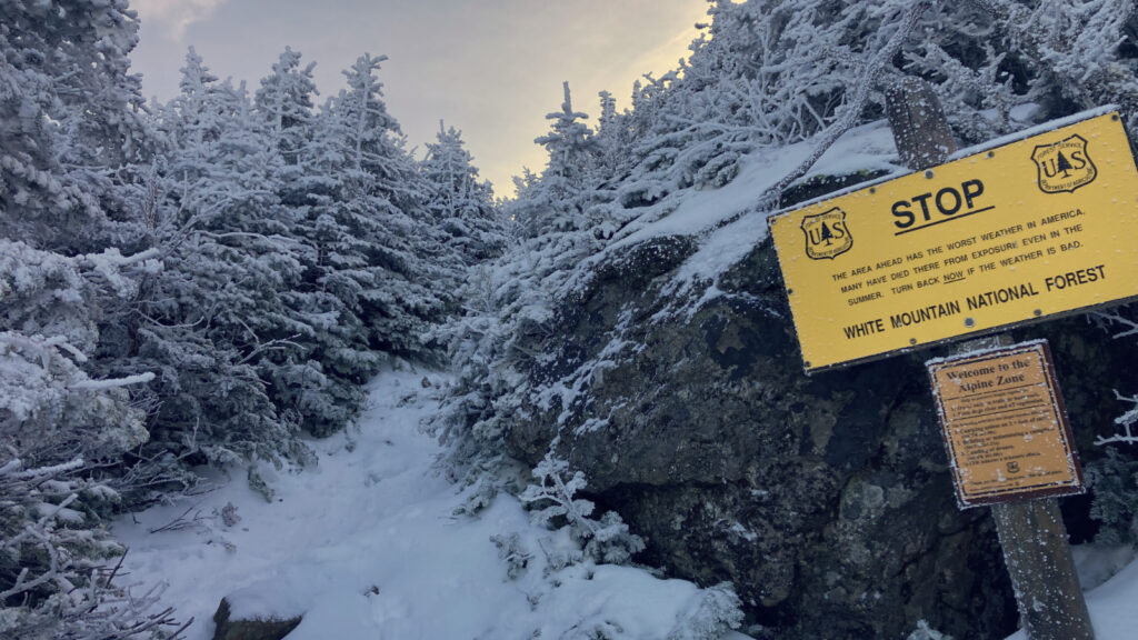
With the recent focus on mortality in the Whites, as we ascend the peaks to seek the divine (or at least the sublime) I felt a certain urgency to get this post out there. Not the least, but there wasn’t a whole lot of information about the trail on NE Trail Conditions, at least where the northern Pressies are concerned. Yikes, I wish it wasn’t so.
It’s been nearly three years (almost exactly 35 months to the day) since one of my most fateful hiking trips — the one where I broke my ankle on Adams. Of course this meant that I’d hike this one now, instead of, say, at the beginning of the month. Does the date have significance, or was it a fluke? Well, to start with, unlike last time, I went to work the next day, no crutches needed. So that’s a win. It was one of the last three on my fifth round of the 48, which is just blind circumstance. (Oh, and obviously, I already have it for December, which it is as I write this, so there was no putting it off.) After a weekend of gnarly weather with hurricane-force winds, this was the first, best weather. Seeing as so far, it’s all just coincidence, is there anything else noteworthy about the timing? Not really, but that’s not saying Adams is just run of the mill. Not in the slightest.
Adams continues to be a very tough cookie. I think it says something if you’re still unpacking lessons, even after the fifth time. I’m not even suggesting that anything untoward happened the other day. As far as a long walk up a mountain goes, it was pretty unremarkable, setting aside the majestic views that I’ve come to expect from that beast. The trail is long and steep and tiring, but the outing was just one foot in front of the other, repeated several thousand times. Over really rough rocks, roots, and rubble. Don’t expect this to be done in a mere hop, skip, and a jump.
Mild weirdness: not much, but just enough.
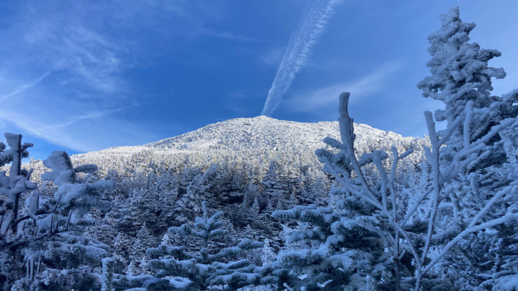
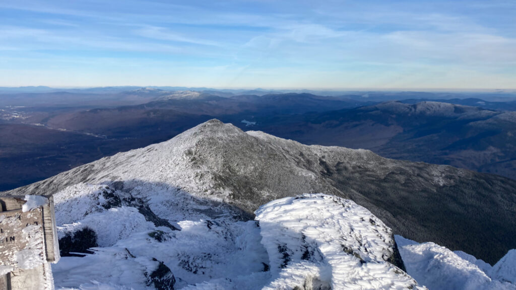
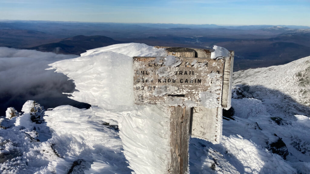
There was some minor route-finding silliness around where Gulfside and Airline trails split off from each other. The cairns are snow-covered, and so a bit camouflaged at the moment. Not enough tramping by others in the thin snow-cover left little to no clues, either. It was resolved easily enough with a little noodling around, but it was a reminder to be careful. Once I was back on track, it was just a matter of time before what I saw in front of me went from “rocks about 100 feet away” to “oh wow. Just… wow.” As I got to within feet and inches of the summit, I kept my eyes on that line, and step after step, the view just expanded exponentially. I get giddy every time that happens.
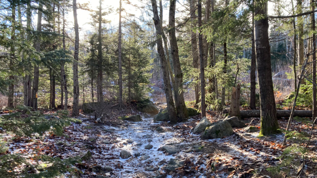
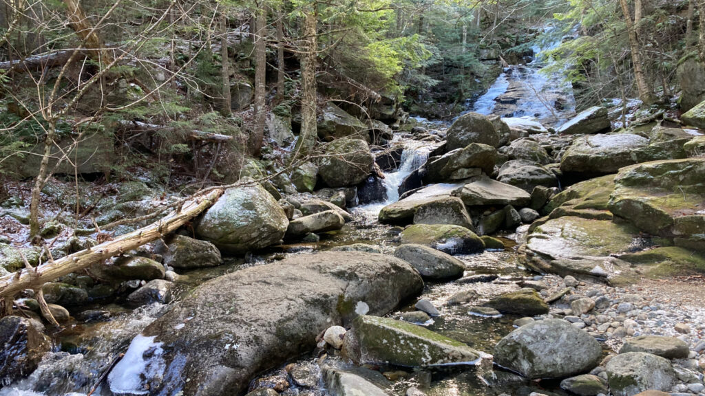
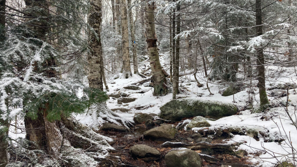
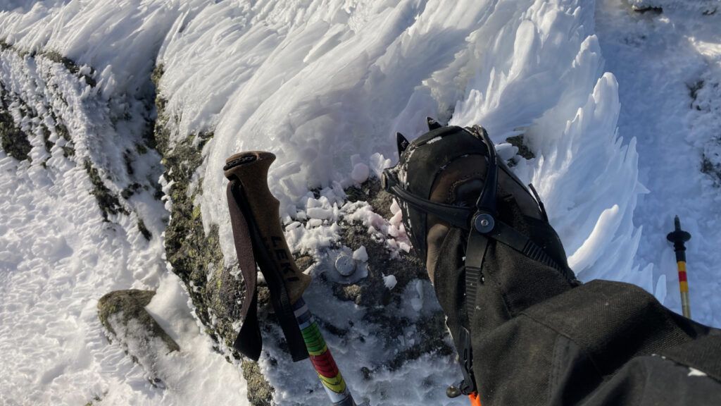
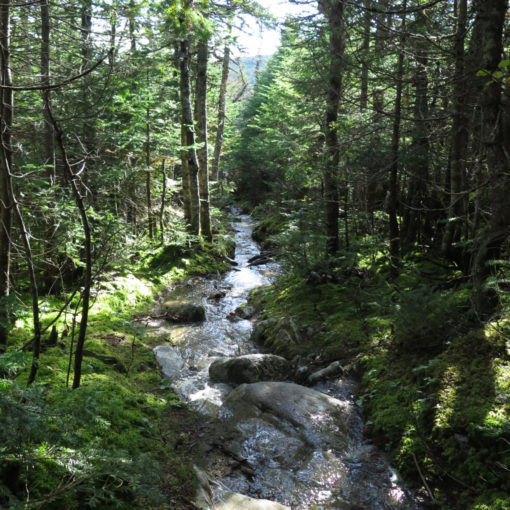
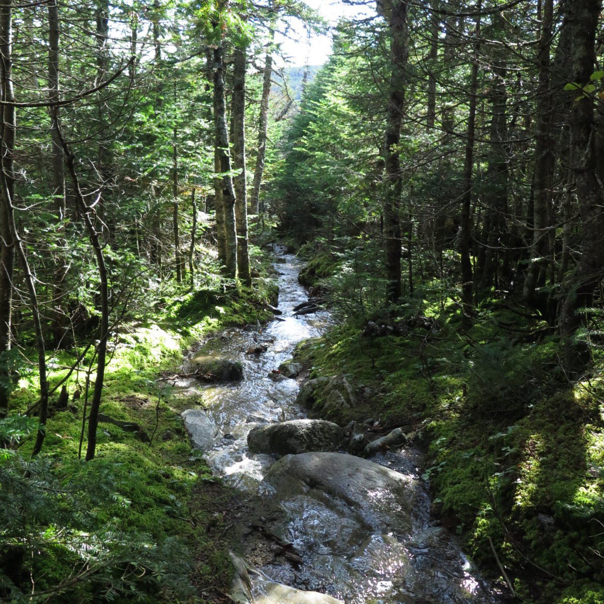
Right now, the trails are weird in the way that only the shoulder seasons can be. I left Appalachia trailhead, and the parking lot was bare ground. Some of the trail down low was dozens of yards of wet leaves and dry rocks, even outright running water. The snow wasn’t a steady presence until I’d put some distance between myself and the car. And even then, while I’d have slipped around a little higher up, micro spikes would have probably been just fine. I was in light-duty crampons (my Hillsounds this time) which felt like a good choice. They were strapped to my pack throughout, but never once did I think snowshoes would come in handy.
Then there was sublime awe in abundance.
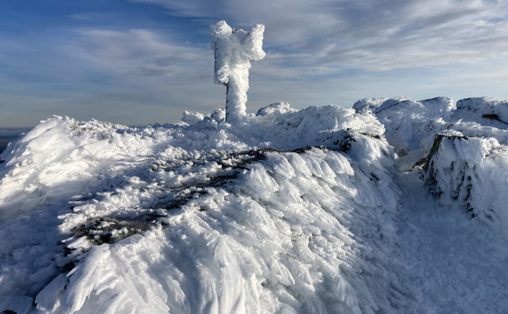
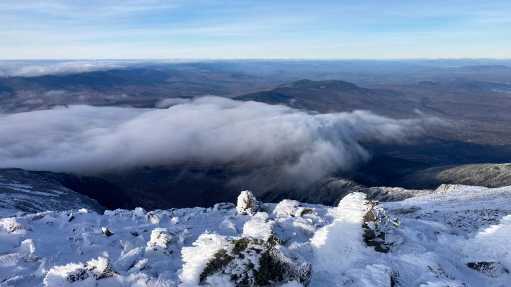
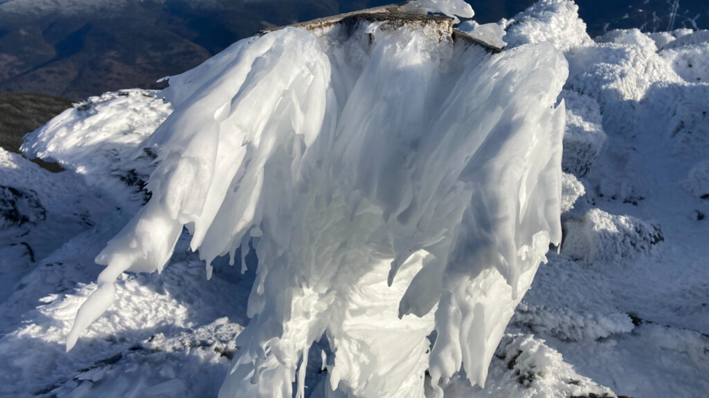
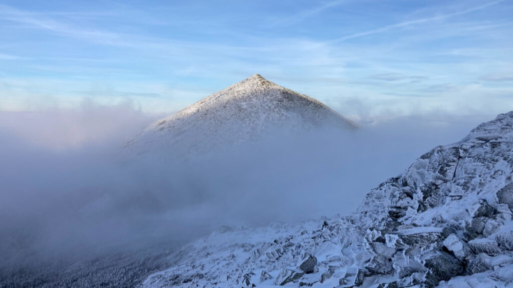
Above treeline, there were some drifts, nothing much. What boggled me nearer to the summit was the rime ice. I’ve seen it time and again on rocks and signs everywhere. I’m not sure I’ve ever seen it on the snow itself. But there it was, and it made the scenery truly magical. Photographing white on white is an exercise in futility, so it was relegated to the camera of the mind. I’m glad just to have seen it in the first place.
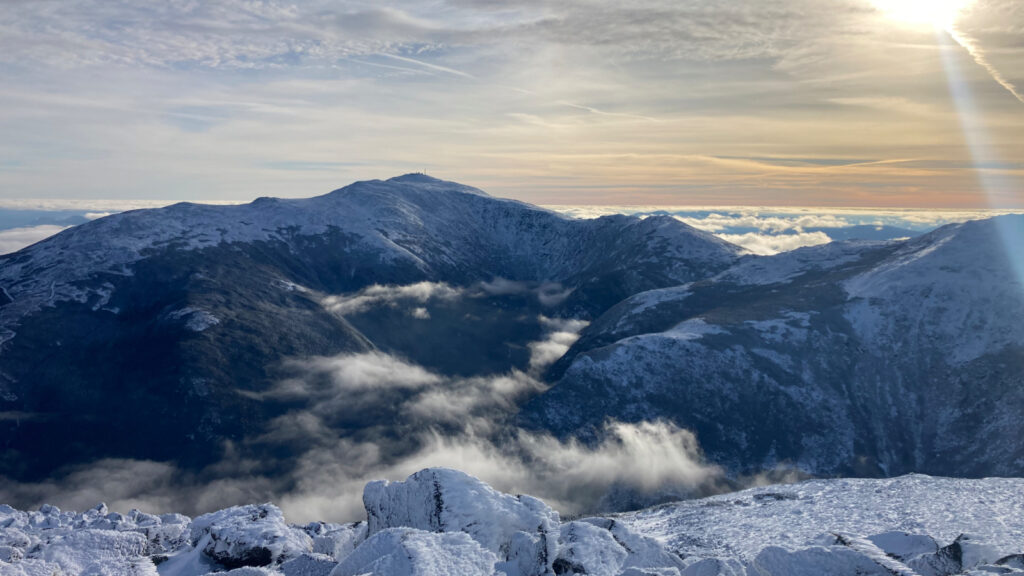
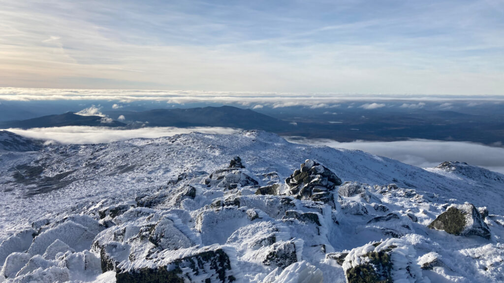
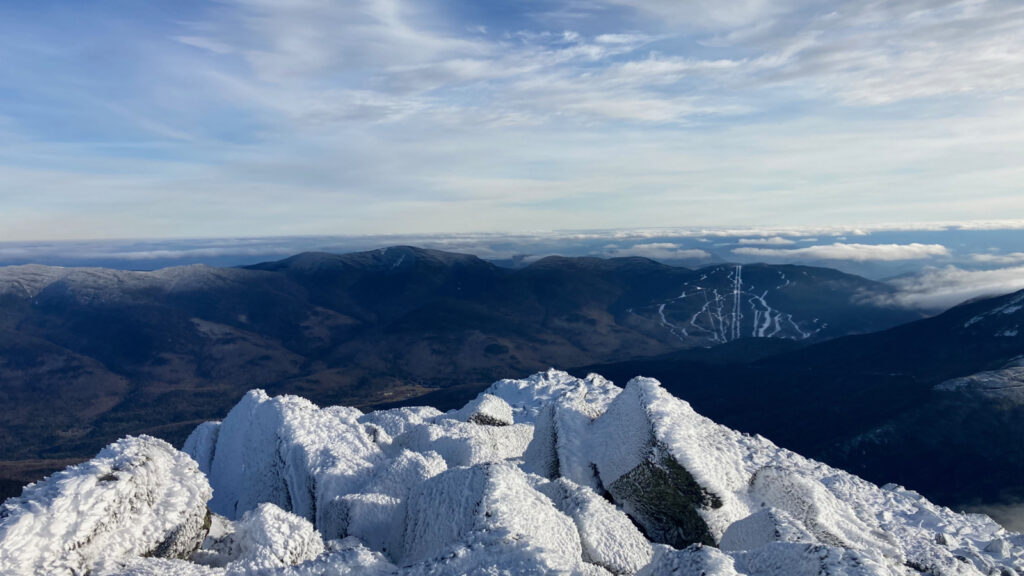
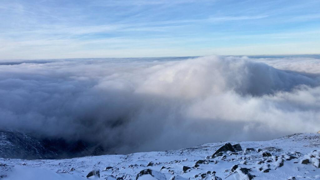
Looking down into the Great Gulf never gets old. This time around, it was a few wispy clouds way down below, just doing not much at all. All around, though, was a soft layer of clouds, stretching as far as the eye could see. No kidding, I caught a glimpse of Carrigain, and *maybe* the Hancocks, but that was it for peaks in the Whites, because very literally, everything else was covered up, certainly to the south, but even much of the north. That’s OK, because I was having a lot of fun just gazing downward into the abyss, and then across to the observatory, and back down into the abyss. The scale of it all just boggles the mind. And to think that all of it was carved out by nothing more than a short bit of time and a little frozen water. Things like this make you feel so small, and yet so thrilled to be aware.
Plus ça change, plus c’est la même chose.*
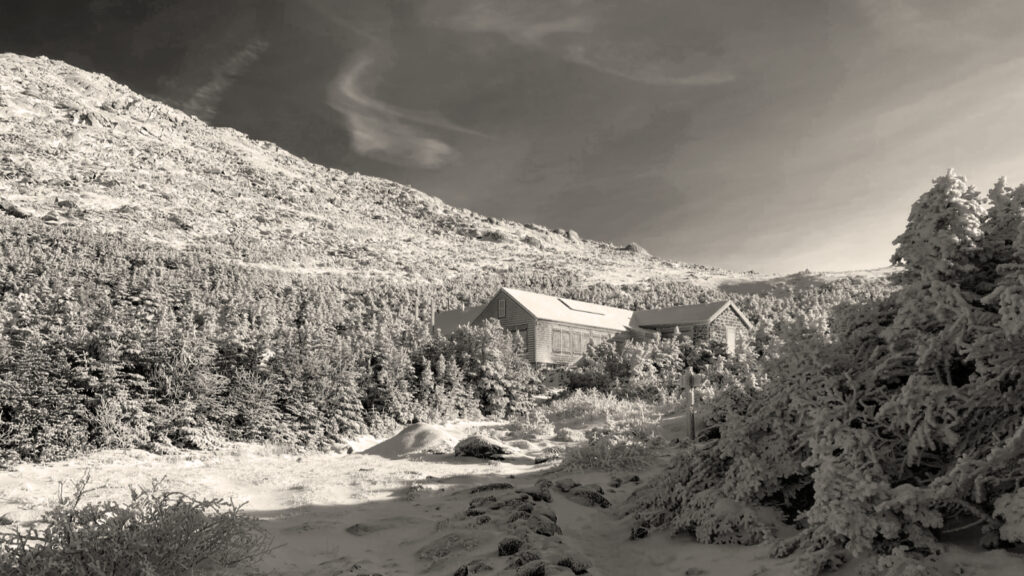
And then the recurring lesson: in the mountains, the only constant is change. I was enjoying wonderful views back down into King Ravine at the top. Then, on the way down, well, I looked around again, and King Ravine was buried under a massive cloud. It had hardly been 20 minutes, and there it was, gone. Similarly, I had a view of Madison on the way down, until minutes later, that was gone, too. Oh yeah, forget about the hut, because that was the first to go. The speed at which visibility went from expansive and awe-inspiring to “maybe the third cairn out” was incredible. It reminded me of a lovely yet viewless day on Mt Washington, where at times, I couldn’t even see the second cairn out. I love these mountains, but they can be sobering when you least expect it. They certainly keep you on your toes. Perhaps that is their greatest gift.
I got back to the hut safely, and from there, the decision was no longer about heading down Airline for its views, but simply Valley Way because I’d just laid footprints there mere hours ago. And hey, there’s something to say about the safety of the trade route from the hut. At that point, it was just time. Darkness fell, I pulled out my headlamp from my pack, and carried on. Slowly, carefully, making deliberate time, not making mistakes. I’ve done this before, so there’s no need to deviate from the winning formula by racing. With no further ado, I was safely back at the car. Victory!
Lessons abounded, maybe more acutely today than usual.
Thinking about Kate Matrosova comes fairly often when I’m in the area of the Presidentials. It was about the time that I ascended to the hut that I was thinking about her in earnest, especially as I looked toward Star Lake, where she was found. It was around 13:30, and sunset came before 16:30 — around three hours away. Time for good decision-making. What’s the value of pressing on, when I knew it all but guaranteed being on the trail after darkness fell? I could turn around now, and easily be back at the car with the last dregs of sunlight still an hour away.
Maybe there was a heightened sense of risk because the trail wasn’t blindingly straightforward. Maybe it was just that Emily died on Lafayette just days ago. But I did ask myself many times in the next half hour or so whether I wanted to keep going, or just leave this one for another day. As things went, summiting won the day. I think it was a solid decision. Once I was well and truly on Airline, it became very straightforward to keep to the trail. The weather was with me, and I came properly equipped.
The reassurance of coming loaded for bear.
The day was pretty superlative. There was a lot of sun, it was relatively warm, and the wind was light. More importantly, my pack was pretty heavy with gear. I’d brought a stove, plenty of food, and enough warm clothing and stuff to hunker down if I needed to. I had my locating beacon, and a map and compass. And so on the summit, I had the freedom to soak in the views in front of me, even though in the center of my mind was the realization that I shouldn’t linger. Conditions were visibly changing by the minute. I might have stayed up there for several minutes, but certainly not as many as ten. Beauty and grandeur in the Whites is fleeting. Gather ye rosebuds while ye may, but then get out of Dodge, fast. The mountains are dispassionate and the clouds made it clear that they weren’t waiting for me.
If Kate and Emily mean anything, it’s that we should pay attention to what we’re doing, not forget what went wrong for them, and do what we need to do in order to make it back to the trailhead. Their misfortune should always guide us. But so too, the mishap I had three years ago stuck in my mind, from the moment I left the house, until the moment I got back to the car. Calamity strikes on its own timetable.
And so, it was a good day out. I have two peaks left on my fifth round of the 48. Many of my sixth round are already in-hand. I have a lot more planning to do. A lot to look forward to. Life is good.
As always, stay safe out there.
Nuts and Bolts: Getting to Adams is a matter of driving up 93, then following Rte 3, 115, and 2 until you see the “Lowe’s Gulf” gas station on the left. At that point, slow down a bit, and watch out for a parking area and trailhead on the right, about a minute after you pass Lowe’s Gulf. A brown sign with “APPALACHIA” marks the trailhead, but if there are a lot of cars in the lot (which is typical, especially on weekends) then you won’t see it from the road. In summer, and on very clement winter weekends, you might spot the trailhead just because of the bevy of cars; if you’re late in the morning, you might need to park alongside the road. Don’t expect solitude.
Several trails share the common trailhead at Appalachia, so be mindful of where you are, at least until you get a fair bit down the trail. Note that you’ll cross the Presidential Rail Trail within moments after you cross the “threshold” of the trailhead, so stay alert as to where you’re going. Air Line and Valley Way are both blazed in blue, and consistently have small arrow signs pointing the way wherever there’s a trail junction. But of course, don’t count on them being there when you visit.
There are dozens of trails on the northern flanks of Jefferson, Adams, and Madison, many of which set out from, or are accessible from Appalachia trailhead, so be very careful at every junction. As always, bring a map and compass, and know how to use them with reasonable skill. I also advise studying the map beforehand, so you have a sense of what to expect when going in.
Note: the Gaia GPS map below has the route covering the entirety of the Airline trail. Modify your trip according to conditions, as I did.
*Plus ça change, plus c’est la même chose: Basically, “the more things change, the more they stay the same.”
If you enjoy reading these posts, please subscribe — stay in the loop! Your email will only be used to alert you of new posts — typically 1-2 times per week. I will not use or share your email for any other purpose without your express permission. And feel free to share via social media using the buttons below.
Find me in the mountains, on this blog, or on Twitter: @Protean_Hiker
Additionally, for all the cool kids who sit in the back of the bus, find me on Mastodon: https://mastodonapp.boston/@Protean_Wanderer
Help support this blog! Visit www.photos.proteanwanderer.com to buy some of my signature images.
One thought on “Trip Report: Mt Adams: Should I stay, or should I go?”